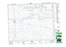
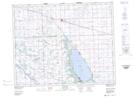
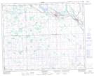
Maps showing Crooked Hill Creek, 3-31-3-W2, Saskatchewan
Crooked Hill Creek is a River located in 3-31-3-W2, Saskatchewan and has an elevation of 489 meters.
- Latitude: 51° 39' North (decimal: 51.6499905)
- Longitude: 102° 20' West (decimal: -102.3338067)
- Topography Feature Category: River
- Geographical Feature: Creek
- Canadian Province/Territory: Saskatchewan
- Elevation: 489 meters
- Location: 3-31-3-W2
- Atlas of Canada Locator Map: Crooked Hill Creek
- GPS Coordinate Locator Map: Crooked Hill Creek Lat/Long
Crooked Hill Creek NTS Map Sheets