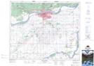
Maps showing Cudworth Junction, 18-48-25-W2, Saskatchewan
Cudworth Junction is a Unincorporated area located in 18-48-25-W2, Saskatchewan.
- Latitude: 53° 11' North (decimal: 53.1833716)
- Longitude: 105° 41' West (decimal: -105.6838412)
- Topography Feature Category: Unincorporated area
- Geographical Feature: Railway Point
- Canadian Province/Territory: Saskatchewan
- Location: 18-48-25-W2
- Atlas of Canada Locator Map: Cudworth Junction
- GPS Coordinate Locator Map: Cudworth Junction Lat/Long
Cudworth Junction NTS Map Sheets