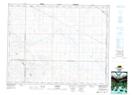
Maps showing Kettlehut, 10-20-4-W3, Saskatchewan
Kettlehut is a Unincorporated area located in 10-20-4-W3, Saskatchewan.
- Latitude: 50° 41' North (decimal: 50.6833645)
- Longitude: 106° 29' West (decimal: -106.4839487)
- Topography Feature Category: Unincorporated area
- Geographical Feature: Railway Point
- Canadian Province/Territory: Saskatchewan
- Location: 10-20-4-W3
- Atlas of Canada Locator Map: Kettlehut
- GPS Coordinate Locator Map: Kettlehut Lat/Long
Kettlehut NTS Map Sheets