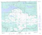
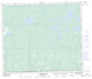
Maps showing Kewatinook Creek, 30-63-22-W3, Saskatchewan
Kewatinook Creek is a River located in 30-63-22-W3, Saskatchewan and has an elevation of 615 meters.
- Latitude: 54° 29' North (decimal: 54.4834248)
- Longitude: 109° 19' West (decimal: -109.3174578)
- Topography Feature Category: River
- Geographical Feature: Creek
- Canadian Province/Territory: Saskatchewan
- Elevation: 615 meters
- Location: 30-63-22-W3
- Atlas of Canada Locator Map: Kewatinook Creek
- GPS Coordinate Locator Map: Kewatinook Creek Lat/Long
Kewatinook Creek NTS Map Sheets