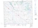
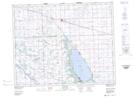
Maps showing Kitchimanitou Beach, 9,17-29-5-W2, Saskatchewan
Kitchimanitou Beach is a Beach located in 9,17-29-5-W2, Saskatchewan and has an elevation of 486 meters.
- Latitude: 51° 30' North (decimal: 51.4999936)
- Longitude: 102° 40' West (decimal: -102.6671453)
- Topography Feature Category: Beach
- Geographical Feature: Beach
- Canadian Province/Territory: Saskatchewan
- Elevation: 486 meters
- Location: 9,17-29-5-W2
- Atlas of Canada Locator Map: Kitchimanitou Beach
- GPS Coordinate Locator Map: Kitchimanitou Beach Lat/Long
Kitchimanitou Beach NTS Map Sheets