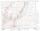
Maps showing Klintonel, 34-8-22-W3, Saskatchewan
Klintonel is a Unincorporated area located in 34-8-22-W3, Saskatchewan and has an elevation of 1086 meters.
- Latitude: 49° 41' North (decimal: 49.6833590)
- Longitude: 108° 55' West (decimal: -108.9173912)
- Topography Feature Category: Unincorporated area
- Geographical Feature: Locality
- Canadian Province/Territory: Saskatchewan
- Elevation: 1086 meters
- Location: 34-8-22-W3
- Atlas of Canada Locator Map: Klintonel
- GPS Coordinate Locator Map: Klintonel Lat/Long
Klintonel NTS Map Sheets