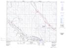
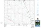
Maps showing Klockow Ravine, 21-26-W2, Saskatchewan
Klockow Ravine is a Valley located in 21-26-W2, Saskatchewan and has an elevation of 578 meters.
- Latitude: 50° 48' North (decimal: 50.8000343)
- Longitude: 105° 33' West (decimal: -105.5505806)
- Topography Feature Category: Valley
- Geographical Feature: Ravine
- Canadian Province/Territory: Saskatchewan
- Elevation: 578 meters
- Location: 21-26-W2
- Atlas of Canada Locator Map: Klockow Ravine
- GPS Coordinate Locator Map: Klockow Ravine Lat/Long
Klockow Ravine NTS Map Sheets