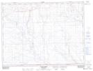
Maps showing Kompan Creek, 16-3-27-W3, Saskatchewan
Kompan Creek is a River located in 16-3-27-W3, Saskatchewan and has an elevation of 933 meters.
- Latitude: 49° 13' North (decimal: 49.2166801)
- Longitude: 109° 35' West (decimal: -109.5840731)
- Topography Feature Category: River
- Geographical Feature: Creek
- Canadian Province/Territory: Saskatchewan
- Elevation: 933 meters
- Location: 16-3-27-W3
- Atlas of Canada Locator Map: Kompan Creek
- GPS Coordinate Locator Map: Kompan Creek Lat/Long
Kompan Creek NTS Map Sheets