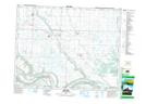
Maps showing Hazel Cliffe, 27-18-33-W, Saskatchewan
Hazel Cliffe is a Unincorporated area located in 27-18-33-W, Saskatchewan and has an elevation of 478 meters.
- Latitude: 50° 34' North (decimal: 50.5666706)
- Longitude: 101° 58' West (decimal: -101.9671423)
- Topography Feature Category: Unincorporated area
- Geographical Feature: Hamlet
- Canadian Province/Territory: Saskatchewan
- Elevation: 478 meters
- Location: 27-18-33-W
- Atlas of Canada Locator Map: Hazel Cliffe
- GPS Coordinate Locator Map: Hazel Cliffe Lat/Long
Hazel Cliffe NTS Map Sheets