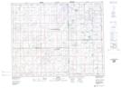
Maps showing Herzel, 30-23-12-W2, Saskatchewan
Herzel is a Unincorporated area located in 30-23-12-W2, Saskatchewan and has an elevation of 649 meters.
- Latitude: 51° 1' North (decimal: 51.0166948)
- Longitude: 103° 41' West (decimal: -103.6838615)
- Topography Feature Category: Unincorporated area
- Geographical Feature: Locality
- Canadian Province/Territory: Saskatchewan
- Elevation: 649 meters
- Location: 30-23-12-W2
- Atlas of Canada Locator Map: Herzel
- GPS Coordinate Locator Map: Herzel Lat/Long