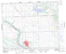
Maps showing Highgate Siding, 17-45-17-W3, Saskatchewan
Highgate Siding is a Unincorporated area located in 17-45-17-W3, Saskatchewan.
- Latitude: 52° 52' North (decimal: 52.8667367)
- Longitude: 108° 25' West (decimal: -108.4173504)
- Topography Feature Category: Unincorporated area
- Geographical Feature: Post Office
- Canadian Province/Territory: Saskatchewan
- Location: 17-45-17-W3
- GPS Coordinate Locator Map: Highgate Siding Lat/Long
Highgate Siding NTS Map Sheets