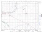
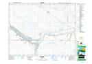
Maps showing High Hill Creek, 20-22-W2, Saskatchewan
High Hill Creek is a River located in 20-22-W2, Saskatchewan and has an elevation of 562 meters.
- Latitude: 50° 37' North (decimal: 50.6167046)
- Longitude: 105° 2' West (decimal: -105.0338914)
- Topography Feature Category: River
- Geographical Feature: Creek
- Canadian Province/Territory: Saskatchewan
- Elevation: 562 meters
- Location: 20-22-W2
- Atlas of Canada Locator Map: High Hill Creek
- GPS Coordinate Locator Map: High Hill Creek Lat/Long
High Hill Creek NTS Map Sheets