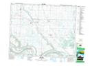
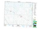
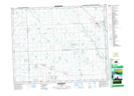
Maps showing Cutarm Creek, 10-18-31-W, Saskatchewan
Cutarm Creek is a River located in 10-18-31-W, Saskatchewan and has an elevation of 467 meters.
- Latitude: 50° 31' North (decimal: 50.5166670)
- Longitude: 101° 40' West (decimal: -101.6671332)
- Topography Feature Category: River
- Geographical Feature: Creek
- Canadian Province/Territory: Saskatchewan
- Elevation: 467 meters
- Location: 10-18-31-W
- Atlas of Canada Locator Map: Cutarm Creek
- GPS Coordinate Locator Map: Cutarm Creek Lat/Long
Cutarm Creek NTS Map Sheets