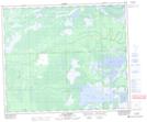
Maps showing Cut Beaver River, 55-5-W2, Saskatchewan
Cut Beaver River is a River located in 55-5-W2, Saskatchewan and has an elevation of 269 meters.
- Latitude: 53° 48' North (decimal: 53.8000439)
- Longitude: 102° 42' West (decimal: -102.7004593)
- Topography Feature Category: River
- Geographical Feature: River
- Canadian Province/Territory: Saskatchewan
- Elevation: 269 meters
- Location: 55-5-W2
- Atlas of Canada Locator Map: Cut Beaver River
- GPS Coordinate Locator Map: Cut Beaver River Lat/Long
Cut Beaver River NTS Map Sheets