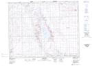
Maps showing Cuthbert, 22-26-29-W3, Saskatchewan
Cuthbert is a Unincorporated area located in 22-26-29-W3, Saskatchewan and has an elevation of 730 meters.
- Latitude: 51° 14' North (decimal: 51.2333944)
- Longitude: 109° 58' West (decimal: -109.9674669)
- Topography Feature Category: Unincorporated area
- Geographical Feature: Railway Point
- Canadian Province/Territory: Saskatchewan
- Elevation: 730 meters
- Location: 22-26-29-W3
- Atlas of Canada Locator Map: Cuthbert
- GPS Coordinate Locator Map: Cuthbert Lat/Long
Cuthbert NTS Map Sheets