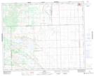
Maps showing Cut Knife, 32-43-21-W3, Saskatchewan
Cut Knife is a Town located in 32-43-21-W3, Saskatchewan and has an elevation of 636 meters.
- Latitude: 52° 44' 51'' North (decimal: 52.7474694)
- Longitude: 109° 0' 57'' West (decimal: -109.0158917)
- Topography Feature Category: Town
- Geographical Feature: Town
- Canadian Province/Territory: Saskatchewan
- Elevation: 636 meters
- Location: 32-43-21-W3
- Atlas of Canada Locator Map: Cut Knife
- GPS Coordinate Locator Map: Cut Knife Lat/Long
Cut Knife NTS Map Sheets