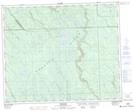
Maps showing Dagg Lake, 48-5-W2, Saskatchewan
Dagg Lake is a Lake located in 48-5-W2, Saskatchewan and has an elevation of 614 meters.
- Latitude: 53° 9' North (decimal: 53.1500279)
- Longitude: 102° 44' West (decimal: -102.7338052)
- Topography Feature Category: Lake
- Geographical Feature: Lake
- Canadian Province/Territory: Saskatchewan
- Elevation: 614 meters
- Location: 48-5-W2
- Atlas of Canada Locator Map: Dagg Lake
- GPS Coordinate Locator Map: Dagg Lake Lat/Long
Dagg Lake NTS Map Sheets