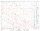
Maps showing Dandonneau, 23-6-17-W2, Saskatchewan
Dandonneau is a Unincorporated area located in 23-6-17-W2, Saskatchewan.
- Latitude: 49° 29' North (decimal: 49.4833647)
- Longitude: 104° 12' West (decimal: -104.2005351)
- Topography Feature Category: Unincorporated area
- Geographical Feature: Railway Point
- Canadian Province/Territory: Saskatchewan
- Location: 23-6-17-W2
- Atlas of Canada Locator Map: Dandonneau
- GPS Coordinate Locator Map: Dandonneau Lat/Long
Dandonneau NTS Map Sheets