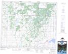
Maps showing Krydor, 15-44-8-W3, Saskatchewan
Krydor is a Village located in 15-44-8-W3, Saskatchewan and has an elevation of 517 meters.
- Latitude: 52° 47' 15'' North (decimal: 52.7874167)
- Longitude: 107° 4' 29'' West (decimal: -107.0748055)
- Topography Feature Category: Village
- Geographical Feature: Village
- Canadian Province/Territory: Saskatchewan
- Elevation: 517 meters
- Location: 15-44-8-W3
- Atlas of Canada Locator Map: Krydor
- GPS Coordinate Locator Map: Krydor Lat/Long