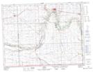
Maps showing Riviere des Lacs, 4-1-2-W2, Saskatchewan
Riviere des Lacs is a River located in 4-1-2-W2, Saskatchewan and has an elevation of 554 meters.
- Latitude: 49° 0' North (decimal: 49.0000249)
- Longitude: 102° 13' West (decimal: -102.2171061)
- Topography Feature Category: River
- Geographical Feature: Rivière
- Canadian Province/Territory: Saskatchewan
- Elevation: 554 meters
- Location: 4-1-2-W2
- Atlas of Canada Locator Map: Riviere des Lacs
- GPS Coordinate Locator Map: Riviere des Lacs Lat/Long