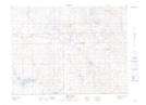
Maps showing Lake Alma, 22-2-17-W2, Saskatchewan
Lake Alma is a Village located in 22-2-17-W2, Saskatchewan and has an elevation of 711 meters.
- Latitude: 49° 8' 41'' North (decimal: 49.1446110)
- Longitude: 104° 11' 51'' West (decimal: -104.1974139)
- Topography Feature Category: Village
- Geographical Feature: Village
- Canadian Province/Territory: Saskatchewan
- Elevation: 711 meters
- Location: 22-2-17-W2
- Atlas of Canada Locator Map: Lake Alma
- GPS Coordinate Locator Map: Lake Alma Lat/Long
Lake Alma NTS Map Sheets