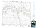
Maps showing Landing Creek, 2-20-15-W3, Saskatchewan
Landing Creek is a River located in 2-20-15-W3, Saskatchewan and has an elevation of 611 meters.
- Latitude: 50° 40' North (decimal: 50.6667061)
- Longitude: 107° 59' West (decimal: -107.9840157)
- Topography Feature Category: River
- Geographical Feature: Creek
- Canadian Province/Territory: Saskatchewan
- Elevation: 611 meters
- Location: 2-20-15-W3
- Atlas of Canada Locator Map: Landing Creek
- GPS Coordinate Locator Map: Landing Creek Lat/Long
Landing Creek NTS Map Sheets