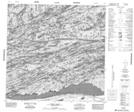
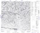
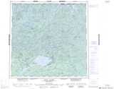
Maps showing Lanegraff Lake, Saskatchewan
Lanegraff Lake is a Lake located in Saskatchewan and has an elevation of 397 meters.
- Latitude: 59° 24' North (decimal: 59.4003314)
- Longitude: 106° 0' West (decimal: -106.0009064)
- Topography Feature Category: Lake
- Geographical Feature: Lake
- Canadian Province/Territory: Saskatchewan
- Elevation: 397 meters
- Atlas of Canada Locator Map: Lanegraff Lake
- GPS Coordinate Locator Map: Lanegraff Lake Lat/Long
Lanegraff Lake NTS Map Sheets