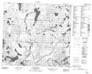
Maps showing Lang Lake, Saskatchewan
Lang Lake is a Lake located in Saskatchewan and has an elevation of 473 meters.
- Latitude: 56° 46' North (decimal: 56.7667597)
- Longitude: 107° 21' West (decimal: -107.3506418)
- Topography Feature Category: Lake
- Geographical Feature: Lake
- Canadian Province/Territory: Saskatchewan
- Elevation: 473 meters
- Atlas of Canada Locator Map: Lang Lake
- GPS Coordinate Locator Map: Lang Lake Lat/Long
Lang Lake NTS Map Sheets