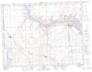
Maps showing Laurie Coulee, 19,20-15,16-W3, Saskatchewan
Laurie Coulee is a Valley located in 19,20-15,16-W3, Saskatchewan and has an elevation of 640 meters.
- Latitude: 50° 40' North (decimal: 50.6667063)
- Longitude: 108° 4' West (decimal: -108.0673526)
- Topography Feature Category: Valley
- Geographical Feature: Coulee
- Canadian Province/Territory: Saskatchewan
- Elevation: 640 meters
- Location: 19,20-15,16-W3
- Atlas of Canada Locator Map: Laurie Coulee
- GPS Coordinate Locator Map: Laurie Coulee Lat/Long