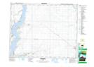
Maps showing Lawson, 9-22-5-W3, Saskatchewan
Lawson is a Unincorporated area located in 9-22-5-W3, Saskatchewan and has an elevation of 628 meters.
- Latitude: 50° 51' North (decimal: 50.8500287)
- Longitude: 106° 39' West (decimal: -106.6506246)
- Topography Feature Category: Unincorporated area
- Geographical Feature: Hamlet
- Canadian Province/Territory: Saskatchewan
- Elevation: 628 meters
- Location: 9-22-5-W3
- Atlas of Canada Locator Map: Lawson
- GPS Coordinate Locator Map: Lawson Lat/Long
Lawson NTS Map Sheets