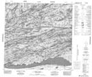
Maps showing Hill Point, Saskatchewan
Hill Point is a Cape located in Saskatchewan and has an elevation of 237 meters.
- Latitude: 59° 17' North (decimal: 59.2837078)
- Longitude: 106° 8' West (decimal: -106.1343068)
- Topography Feature Category: Cape
- Geographical Feature: Point
- Canadian Province/Territory: Saskatchewan
- Elevation: 237 meters
- Atlas of Canada Locator Map: Hill Point
- GPS Coordinate Locator Map: Hill Point Lat/Long
Hill Point NTS Map Sheets