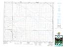
Maps showing Darmody, 24-20-3-W3, Saskatchewan
Darmody is a Unincorporated area located in 24-20-3-W3, Saskatchewan and has an elevation of 599 meters.
- Latitude: 50° 43' North (decimal: 50.7166983)
- Longitude: 106° 17' West (decimal: -106.2839412)
- Topography Feature Category: Unincorporated area
- Geographical Feature: Hamlet
- Canadian Province/Territory: Saskatchewan
- Elevation: 599 meters
- Location: 24-20-3-W3
- Atlas of Canada Locator Map: Darmody
- GPS Coordinate Locator Map: Darmody Lat/Long
Darmody NTS Map Sheets