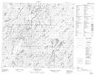
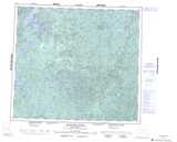
Maps showing David Rapids, Saskatchewan
David Rapids is a Rapids located in Saskatchewan and has an elevation of 475 meters.
- Latitude: 56° 27' North (decimal: 56.4500858)
- Longitude: 106° 25' West (decimal: -106.4172400)
- Topography Feature Category: Rapids
- Geographical Feature: Rapids
- Canadian Province/Territory: Saskatchewan
- Elevation: 475 meters
- Atlas of Canada Locator Map: David Rapids
- GPS Coordinate Locator Map: David Rapids Lat/Long
David Rapids NTS Map Sheets