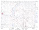
Maps showing Davyroyd, 8,9-28-W2, Saskatchewan
Davyroyd is a Unincorporated area located in 8,9-28-W2, Saskatchewan and has an elevation of 702 meters.
- Latitude: 49° 42' North (decimal: 49.7000282)
- Longitude: 105° 44' West (decimal: -105.7339033)
- Topography Feature Category: Unincorporated area
- Geographical Feature: Locality
- Canadian Province/Territory: Saskatchewan
- Elevation: 702 meters
- Location: 8,9-28-W2
- Atlas of Canada Locator Map: Davyroyd
- GPS Coordinate Locator Map: Davyroyd Lat/Long
Davyroyd NTS Map Sheets