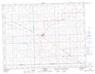
Maps showing Deborah, 32-3-4-W2, Saskatchewan
Deborah is a Unincorporated area located in 32-3-4-W2, Saskatchewan and has an elevation of 582 meters.
- Latitude: 49° 15' North (decimal: 49.2500274)
- Longitude: 102° 31' West (decimal: -102.5171211)
- Topography Feature Category: Unincorporated area
- Geographical Feature: Railway Point
- Canadian Province/Territory: Saskatchewan
- Elevation: 582 meters
- Location: 32-3-4-W2
- Atlas of Canada Locator Map: Deborah
- GPS Coordinate Locator Map: Deborah Lat/Long