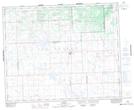
Maps showing Deception Lake, 11-39-17-W3, Saskatchewan
Deception Lake is a Lake located in 11-39-17-W3, Saskatchewan and has an elevation of 672 meters.
- Latitude: 52° 20' North (decimal: 52.3333920)
- Longitude: 108° 21' West (decimal: -108.3506911)
- Topography Feature Category: Lake
- Geographical Feature: Lake
- Canadian Province/Territory: Saskatchewan
- Elevation: 672 meters
- Location: 11-39-17-W3
- Atlas of Canada Locator Map: Deception Lake
- GPS Coordinate Locator Map: Deception Lake Lat/Long
Deception Lake NTS Map Sheets