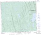
Maps showing De La Ronde Creek, 64-18-W3, Saskatchewan
De La Ronde Creek is a River located in 64-18-W3, Saskatchewan and has an elevation of 492 meters.
- Latitude: 54° 33' North (decimal: 54.5500927)
- Longitude: 108° 37' West (decimal: -108.6174072)
- Topography Feature Category: River
- Geographical Feature: Creek
- Canadian Province/Territory: Saskatchewan
- Elevation: 492 meters
- Location: 64-18-W3
- Atlas of Canada Locator Map: De La Ronde Creek
- GPS Coordinate Locator Map: De La Ronde Creek Lat/Long
De La Ronde Creek NTS Map Sheets