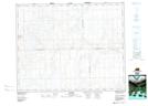
Maps showing Dewar Lake, 4-31-26-W3, Saskatchewan
Dewar Lake is a Unincorporated area located in 4-31-26-W3, Saskatchewan and has an elevation of 712 meters.
- Latitude: 51° 38' North (decimal: 51.6333938)
- Longitude: 109° 38' West (decimal: -109.6341005)
- Topography Feature Category: Unincorporated area
- Geographical Feature: Hamlet
- Canadian Province/Territory: Saskatchewan
- Elevation: 712 meters
- Location: 4-31-26-W3
- Atlas of Canada Locator Map: Dewar Lake
- GPS Coordinate Locator Map: Dewar Lake Lat/Long