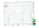
Maps showing Leech Lake, 24-4-W2, Saskatchewan
Leech Lake is a Lake located in 24-4-W2, Saskatchewan and has an elevation of 508 meters.
- Latitude: 51° 5' North (decimal: 51.0833341)
- Longitude: 102° 28' West (decimal: -102.4671453)
- Topography Feature Category: Lake
- Geographical Feature: Lake
- Canadian Province/Territory: Saskatchewan
- Elevation: 508 meters
- Location: 24-4-W2
- Atlas of Canada Locator Map: Leech Lake
- GPS Coordinate Locator Map: Leech Lake Lat/Long