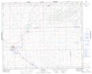
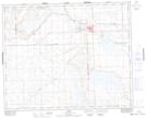
Maps showing Leier Lake, 39-25-W3, Saskatchewan
Leier Lake is a Lake located in 39-25-W3, Saskatchewan and has an elevation of 657 meters.
- Latitude: 52° 22' North (decimal: 52.3667368)
- Longitude: 109° 30' West (decimal: -109.5007490)
- Topography Feature Category: Lake
- Geographical Feature: Lake
- Canadian Province/Territory: Saskatchewan
- Elevation: 657 meters
- Location: 39-25-W3
- Atlas of Canada Locator Map: Leier Lake
- GPS Coordinate Locator Map: Leier Lake Lat/Long
Leier Lake NTS Map Sheets