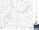
Maps showing Lepine, 19-42-25-W2, Saskatchewan
Lepine is a Unincorporated area located in 19-42-25-W2, Saskatchewan and has an elevation of 531 meters.
- Latitude: 52° 38' North (decimal: 52.6333634)
- Longitude: 105° 35' West (decimal: -105.5838766)
- Topography Feature Category: Unincorporated area
- Geographical Feature: Locality
- Canadian Province/Territory: Saskatchewan
- Elevation: 531 meters
- Location: 19-42-25-W2
- Atlas of Canada Locator Map: Lepine
- GPS Coordinate Locator Map: Lepine Lat/Long