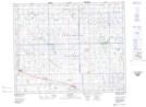
Maps showing Leross, 11-27A-14-W2, Saskatchewan
Leross is a Village located in 11-27A-14-W2, Saskatchewan and has an elevation of 671 meters.
- Latitude: 51° 17' 18'' North (decimal: 51.2884471)
- Longitude: 103° 52' 15'' West (decimal: -103.8707638)
- Topography Feature Category: Village
- Geographical Feature: Village
- Canadian Province/Territory: Saskatchewan
- Elevation: 671 meters
- Location: 11-27A-14-W2
- Atlas of Canada Locator Map: Leross
- GPS Coordinate Locator Map: Leross Lat/Long