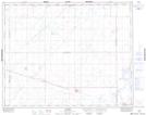
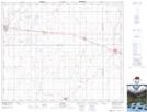
Maps showing Leroy, 13-35-20-W2, Saskatchewan
Leroy is a Town located in 13-35-20-W2, Saskatchewan and has an elevation of 551 meters.
- Latitude: 52° 0' 10'' North (decimal: 52.0029082)
- Longitude: 104° 44' 20'' West (decimal: -104.7388222)
- Topography Feature Category: Town
- Geographical Feature: Town
- Canadian Province/Territory: Saskatchewan
- Elevation: 551 meters
- Location: 13-35-20-W2
- Atlas of Canada Locator Map: Leroy
- GPS Coordinate Locator Map: Leroy Lat/Long
Leroy NTS Map Sheets