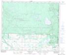
Maps showing LeRoy Lake, 55-3-W3, Saskatchewan
LeRoy Lake is a Lake located in 55-3-W3, Saskatchewan and has an elevation of 647 meters.
- Latitude: 53° 43' North (decimal: 53.7167186)
- Longitude: 106° 25' West (decimal: -106.4171966)
- Topography Feature Category: Lake
- Geographical Feature: Lake
- Canadian Province/Territory: Saskatchewan
- Elevation: 647 meters
- Location: 55-3-W3
- Atlas of Canada Locator Map: LeRoy Lake
- GPS Coordinate Locator Map: LeRoy Lake Lat/Long
LeRoy Lake NTS Map Sheets