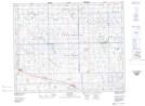
Maps showing Lestock, 6-27-14-W2, Saskatchewan
Lestock is a Village located in 6-27-14-W2, Saskatchewan and has an elevation of 648 meters.
- Latitude: 51° 18' 39'' North (decimal: 51.3108693)
- Longitude: 103° 58' 48'' West (decimal: -103.9800472)
- Topography Feature Category: Village
- Geographical Feature: Village
- Canadian Province/Territory: Saskatchewan
- Elevation: 648 meters
- Location: 6-27-14-W2
- Atlas of Canada Locator Map: Lestock
- GPS Coordinate Locator Map: Lestock Lat/Long