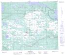
Maps showing L'Heureux Lake, 62,63-25-W3, Saskatchewan
L'Heureux Lake is a Lake located in 62,63-25-W3, Saskatchewan and has an elevation of 540 meters.
- Latitude: 54° 25' North (decimal: 54.4167574)
- Longitude: 109° 42' West (decimal: -109.7008173)
- Topography Feature Category: Lake
- Geographical Feature: Lake
- Canadian Province/Territory: Saskatchewan
- Elevation: 540 meters
- Location: 62,63-25-W3
- Atlas of Canada Locator Map: L'Heureux Lake
- GPS Coordinate Locator Map: L'Heureux Lake Lat/Long
L'Heureux Lake NTS Map Sheets