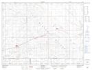
Maps showing Lightfoot Lake, 33-6-22-W2, Saskatchewan
Lightfoot Lake is a Lake located in 33-6-22-W2, Saskatchewan and has an elevation of 729 meters.
- Latitude: 49° 31' North (decimal: 49.5166989)
- Longitude: 104° 55' West (decimal: -104.9172098)
- Topography Feature Category: Lake
- Geographical Feature: Lake
- Canadian Province/Territory: Saskatchewan
- Elevation: 729 meters
- Location: 33-6-22-W2
- Atlas of Canada Locator Map: Lightfoot Lake
- GPS Coordinate Locator Map: Lightfoot Lake Lat/Long
Lightfoot Lake NTS Map Sheets