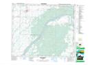
Maps showing Lily Plain, 28-48-1-W3, Saskatchewan
Lily Plain is a Unincorporated area located in 28-48-1-W3, Saskatchewan and has an elevation of 460 meters.
- Latitude: 53° 10' North (decimal: 53.1667104)
- Longitude: 106° 5' West (decimal: -106.0838608)
- Topography Feature Category: Unincorporated area
- Geographical Feature: Locality
- Canadian Province/Territory: Saskatchewan
- Elevation: 460 meters
- Location: 28-48-1-W3
- Atlas of Canada Locator Map: Lily Plain
- GPS Coordinate Locator Map: Lily Plain Lat/Long
Lily Plain NTS Map Sheets