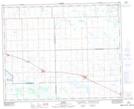
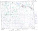
Maps showing Lone Spruce, 12-34-8-W2, Saskatchewan
Lone Spruce is a Unincorporated area located in 12-34-8-W2, Saskatchewan.
- Latitude: 51° 55' North (decimal: 51.9166585)
- Longitude: 103° 0' West (decimal: -103.0004840)
- Topography Feature Category: Unincorporated area
- Geographical Feature: Locality
- Canadian Province/Territory: Saskatchewan
- Location: 12-34-8-W2
- Atlas of Canada Locator Map: Lone Spruce
- GPS Coordinate Locator Map: Lone Spruce Lat/Long
Lone Spruce NTS Map Sheets