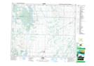
Maps showing Parkside, 28-48-4-W3, Saskatchewan
Parkside is a Village located in 28-48-4-W3, Saskatchewan and has an elevation of 483 meters.
- Latitude: 53° 9' 58'' North (decimal: 53.1660111)
- Longitude: 106° 32' 2'' West (decimal: -106.5339316)
- Topography Feature Category: Village
- Geographical Feature: Village
- Canadian Province/Territory: Saskatchewan
- Elevation: 483 meters
- Location: 28-48-4-W3
- Atlas of Canada Locator Map: Parkside
- GPS Coordinate Locator Map: Parkside Lat/Long