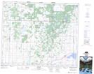
Maps showing Lac la Pêche, 46-8-W3, Saskatchewan
Lac la Pêche is a Lake located in 46-8-W3, Saskatchewan and has an elevation of 602 meters.
- Latitude: 52° 57' North (decimal: 52.9500500)
- Longitude: 107° 4' West (decimal: -107.0672535)
- Topography Feature Category: Lake
- Geographical Feature: Lac
- Canadian Province/Territory: Saskatchewan
- Elevation: 602 meters
- Location: 46-8-W3
- Atlas of Canada Locator Map: Lac la Pêche
- GPS Coordinate Locator Map: Lac la Pêche Lat/Long