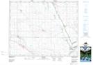
Maps showing Pelican Pointe, 19,30-21-22-W2, Saskatchewan
Pelican Pointe is a Village located in 19,30-21-22-W2, Saskatchewan and has an elevation of 503 meters.
- Latitude: 50° 48' 14'' North (decimal: 50.8038721)
- Longitude: 105° 2' 12'' West (decimal: -105.0366527)
- Topography Feature Category: Village
- Geographical Feature: Resort Village
- Canadian Province/Territory: Saskatchewan
- Elevation: 503 meters
- Location: 19,30-21-22-W2
- Atlas of Canada Locator Map: Pelican Pointe
- GPS Coordinate Locator Map: Pelican Pointe Lat/Long