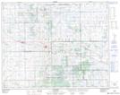
Maps showing Pelletier Lake, 8-27A-15-W2, Saskatchewan
Pelletier Lake is a Lake located in 8-27A-15-W2, Saskatchewan and has an elevation of 668 meters.
- Latitude: 51° 17' North (decimal: 51.2833716)
- Longitude: 104° 5' West (decimal: -104.0838740)
- Topography Feature Category: Lake
- Geographical Feature: Lake
- Canadian Province/Territory: Saskatchewan
- Elevation: 668 meters
- Location: 8-27A-15-W2
- Atlas of Canada Locator Map: Pelletier Lake
- GPS Coordinate Locator Map: Pelletier Lake Lat/Long