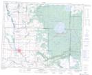
Maps showing Pelly Bay, Saskatchewan
Pelly Bay is a Bay located in Saskatchewan and has an elevation of 624 meters.
- Latitude: 51° 39' North (decimal: 51.6499920)
- Longitude: 101° 40' West (decimal: -101.6671293)
- Topography Feature Category: Bay
- Geographical Feature: Bay
- Canadian Province/Territory: Saskatchewan
- Elevation: 624 meters
- Atlas of Canada Locator Map: Pelly Bay
- GPS Coordinate Locator Map: Pelly Bay Lat/Long
Pelly Bay NTS Map Sheets